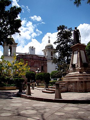
Tixtla
Tixtla | |
|---|---|
Municipal seat and city | |
 | |
| Coordinates: 17°34′N 99°24′W / 17.567°N 99.400°W | |
| Country | |
| State | Guerrero |
| Municipality | Tixtla de Guerrero |
| Population (2005) | |
• Total | 21,720 |
| Time zone | UTC-6 (Zona Centro) |
Tixtla (formally, Tixtla de Guerrero) (Spanish: [ˈtiɣstla ðe ɣeˈreɾo], Nahuatl: [ˈtiʃt͡ɬa]) is a town and seat of the municipality of Tixtla de Guerrero in the Mexican state of Guerrero. The name is Nahuatl, and means either "maize dough" (masa) from textli; "our valley" from to ixtla; or "temple by the water" from teoixtlen'
History
[edit]Antonia Nava de Catalán, a heroine of the Mexican War of Independence, was born in Tixtla.[1] Tixtla was also the birthplace of both Independence hero and Mexican president Vicente Guerrero (1783–1831) and writer and educator Ignacio Manuel Altamirano (1834–1893). It served as the first capital of Guerrero, from 1851 to 1870, and the state constitution was promulgated there on 14 June 1851.[2]
Geography
[edit]The municipality is located between 17°20' & 17°43' N and 99°15' & 99°28' W, some 20 km (12 mi) east of state capital Chilpancingo. It covers a total surface area of 290 km2 (110 sq mi). It reported 33,620 people in the 2000 census, including 18% Native Americans (speakers of Nahuatl and Tlapaneco).
Other towns in the municipality include Atliaca (population 5,981), Almolonga (1,346), Zoquiapa (1,243), and El Durazno (1,070).
Climate
[edit]| Climate data for Tixtla de Guerrero | |||||||||||||
|---|---|---|---|---|---|---|---|---|---|---|---|---|---|
| Month | Jan | Feb | Mar | Apr | May | Jun | Jul | Aug | Sep | Oct | Nov | Dec | Year |
| [citation needed] | |||||||||||||
Culture
[edit]The city is known for its music and festivals.[3]
Notable people
[edit]References
[edit]- ^ JSA/JOSR, "Nava de Catalán, Antonia", enciclopediagro (in Spanish), Guerrero Cultural Siglo XXI, retrieved 2017-11-27
- ^ Gobierno del Estado de Guerrero: Subdirección de Gobierno en Línea (2015-10-28). "Tixtla de Guerrero". Portal Oficial del Gobierno del Estado de Guerrero (in Mexican Spanish). Retrieved 2020-02-08.
- ^ "Sones de tarima de Tixtla". Mediateca Guerrero (in Spanish). 2016-12-28. Retrieved 2020-02-08.


